FISHING ● PADDLING ● HIKING ● BIRDING
The upper section of Canadaway Creek begins as a rivulet along the northwest side of Boutwell Hill in the town of Charlotte and flows for about 7 miles before reaching the end of the stocked section, which is about a half mile upstream (i.e., south) of Arkwright Falls. Initially, the stream flows north and is typical of the hillside drainages found in this area, being quite small and fed largely by cold groundwater. Canadaway Creek remains quite small until it runs into the toe of Dibble Hill about 1,000 feet south of Bard Road and is forced to turn to the northwest. Shortly thereafter, it crosses under Griswold Road, enters the Canadaway Creek Wildlife Management Area (WMA), picks up flow from two tributaries (none of the tributaries of this stream are fishable), and becomes large enough to fish. It then flows for about 1,500 feet before crossing under Bard Road near Park Road. (The map pin is located on the DEC parking area adjacent to the remnant of Park Road.)
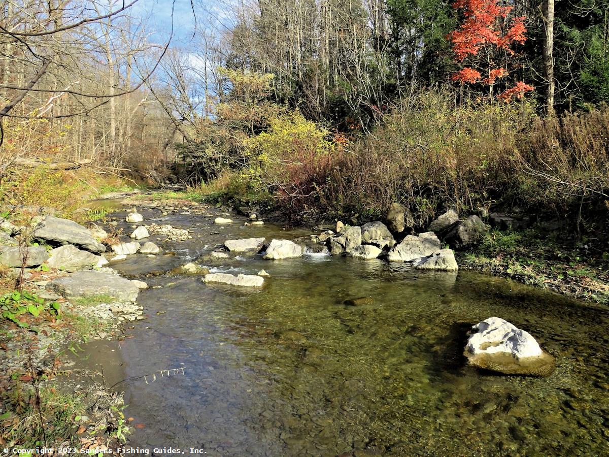
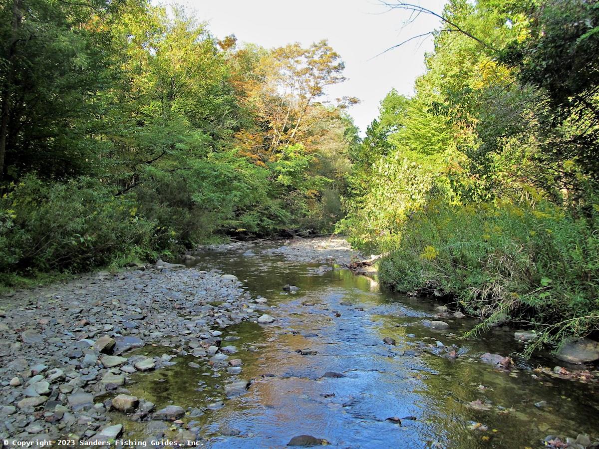
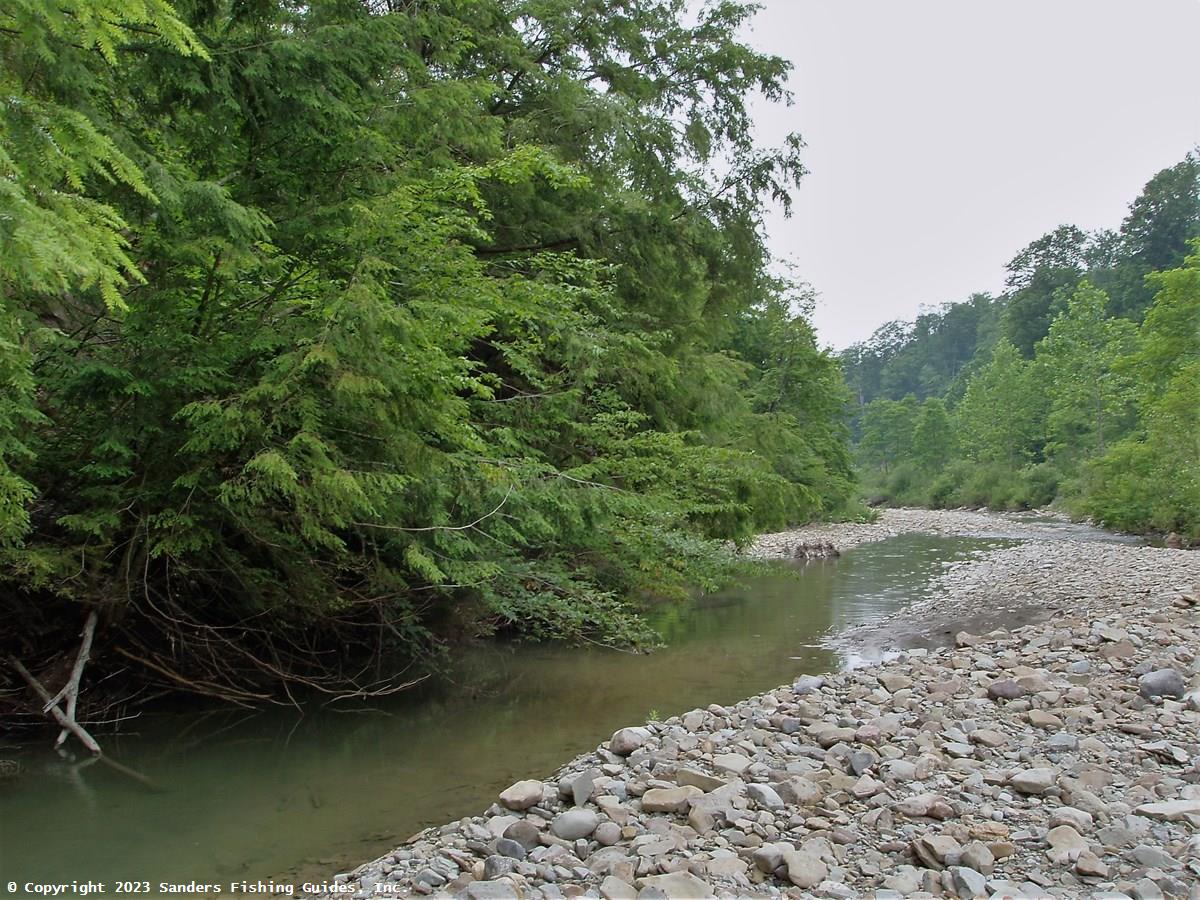
Depending on the amount of recent rainfall, the section of Canadaway Creek downstream of Bard Road ranges from 10 to 20 feet in width and meanders over a bed of cobbles, gravel, and shale. The flow is generally clear and cool, and the surrounding land consists of a mix of woodlands and low gorge, with the latter becoming deeper as the stream flows generally northwestward. Within the WMA, there is limited overhanging streamside vegetation to shade the water and provide cover for fish, but large boulders and numerous piles of large woody debris create pools that provide refuge for trout.
The section of stream that flows through the Canadaway Creek WMA is stocked annually with brown trout and rainbow trout, providing stream fishing in a remote and beautiful setting. This is generally a spring/early summer fishery, but occasionally a few trout will survive well into the summer in some of the larger pools, and I’ve seen a few of these fish while hiking here in July and August. Nevertheless, trout fishing in the WMA is largely over by late June.
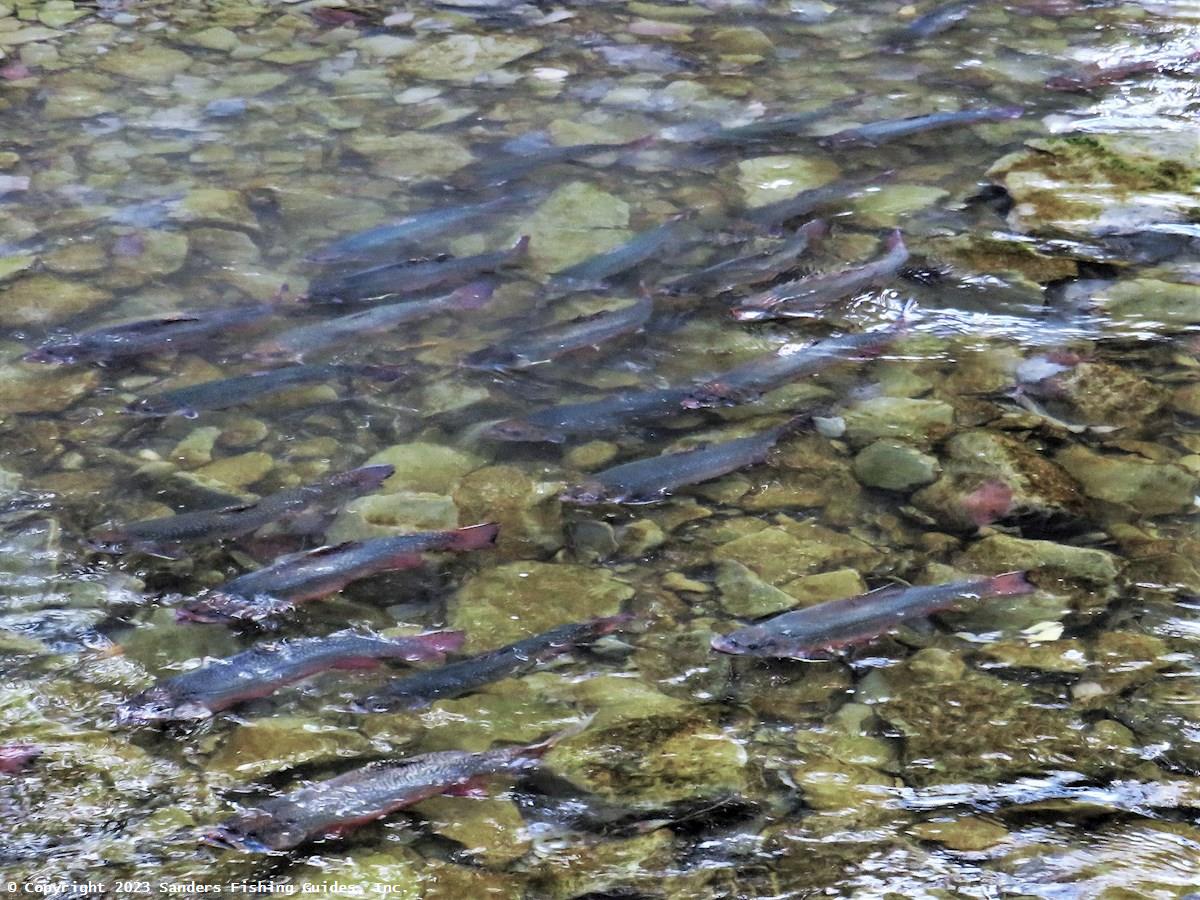
While the numerous pools found in this section provide habitat mostly for stocked trout, on rare occasions wild rainbow trout are encountered. During a trout population survey conducted here in 1999, the DEC captured wild rainbow trout from at least two year classes, though no rainbows were captured during follow-up surveys conducted in 2000 and 2010. Based on these findings, the DEC has speculated that there may be limited natural reproduction of rainbow trout in this section of the stream or its tributaries. I also saw rainbows in this section around 2003 and again in 2012, well before rainbows were stocked here.
Around 2005, while hiking along this section of Canadaway Creek in the fall, I detected the distinct salmon-like odor of steelhead. When I contacted the DEC about this, they said that no steelhead would be found that far up in the stream and that I was mistaken. However, several weeks later, an angler called me and said that he had just caught a steelhead in the same area where I had smelled them. In addition, over the years, several other anglers have told me that they have caught steelhead in this section of the stream.
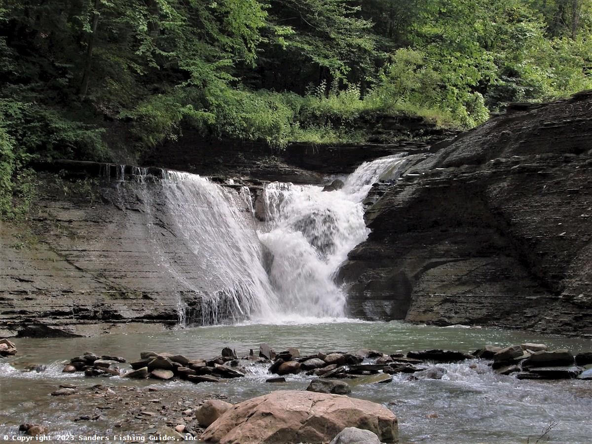
Steelhead occur in large numbers in the lower section of Canadaway Creek, but I don’t see how these fish could make it over the waterfall at Webster Street in in Laona. Perhaps some anglers occasionally release the steelhead they've caught above the waterfall (this has been known to occur on several steelhead streams), and these fish then move upstream into the WMA. This would require the fish to make it over Shumla Falls, which looks doable, and Arkwright Falls, which seems unlikely, but how else would a few steelhead make their way into the upper section of Canadaway Creek? The DEC's Region 9 inland fisheries biologist, Scott Cornett, has speculated that perhaps the wild rainbow trout encountered by the DEC in 1999 are the progeny of steelhead that succeeded in making the journey. For some interesting information on the ability of steelhead to get over waterfalls, see "Sultan River Fish Passage" under Links. The article is based on a study of salmon and steelhead in the Sultan River of Washington State. Especially interesting are Tables 1, 2, and 4.
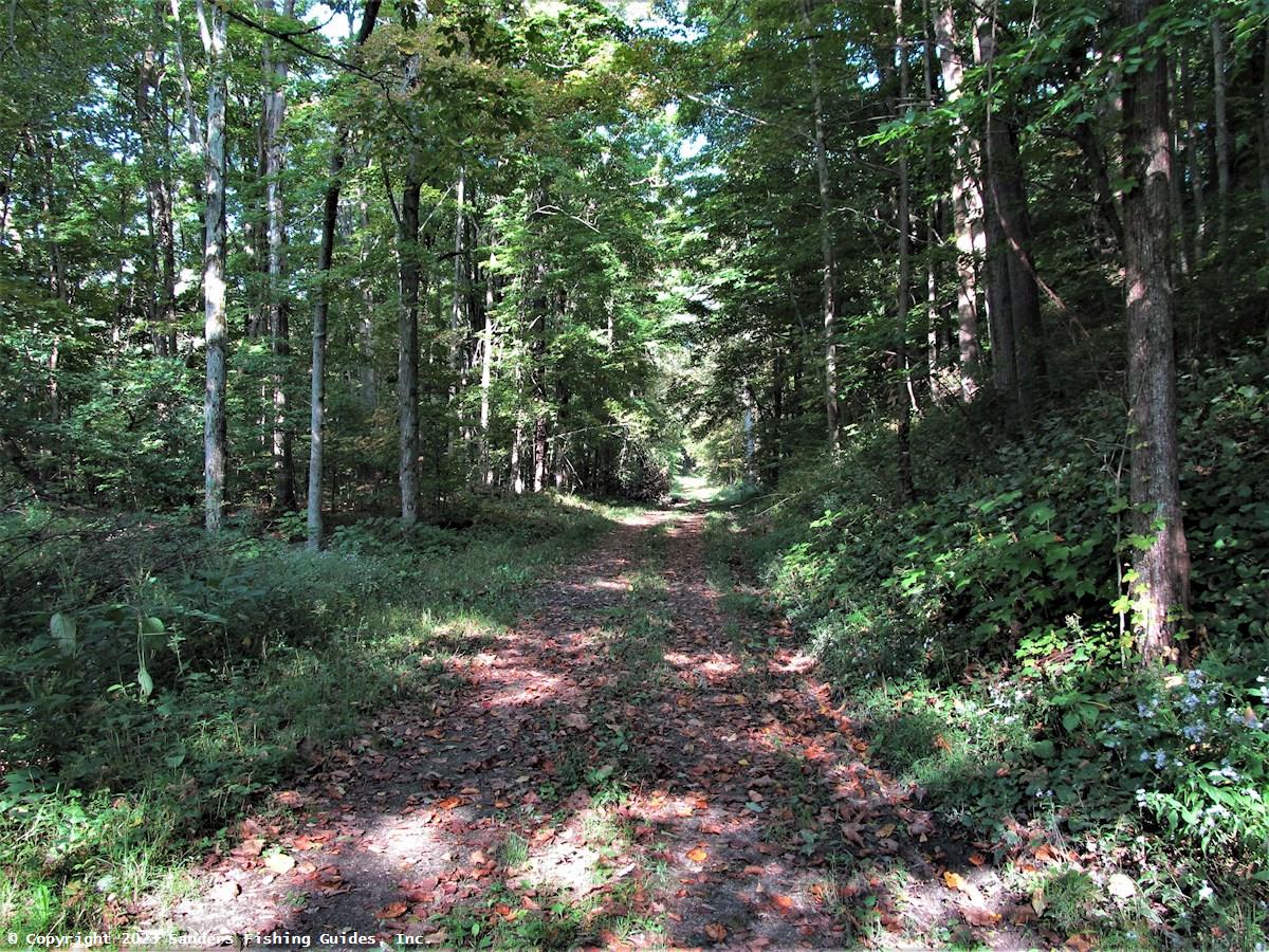
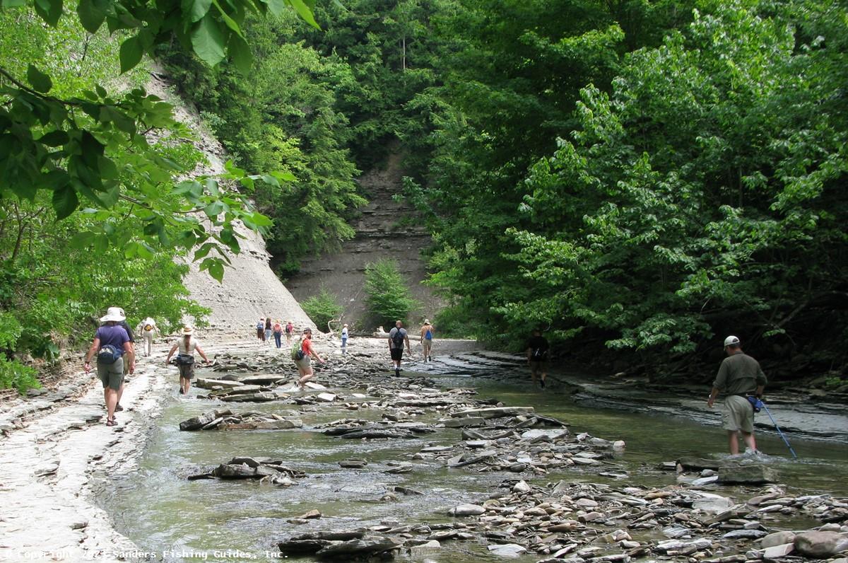
Nearly all of the stocked section of Canadaway Creek has public access, either in the WMA, which is state property, or where the stream flows through a parcel of county property. Other than the 700-yard section of the stream that flows through the WMA south of Bard Road, the stocked section of Canadaway Creek is accessed by hiking along Park Road and then dropping down to the stream. Long ago, Park Road was drivable from Bard Road north to Ball Road, but now all but the northernmost section of the road is just a hiking trail that parallels the stocked section of the stream at distances ranging from 200 to 400 feet until it turns northward toward Ball Road.
The stocked section of Canadaway Creek can also be accessed from Park Road where it enters the WMA from the north; turn left off Ball Road and continue south on Park Road until the road is barricaded. From here you can hike down the remnant of Park Road to the stocked section of the stream, but you have to hike over half a mile before you can easily and safely access the stream.
Whether you access the stream from the north or south end of Park Road, be aware that you have to scramble down a steep hillside to get to the stream, and it seems even steeper going back up. This stream is in a very remote area, so be prepared and always carry the Ten Essentials for Hiking (see Links).
No article on Canadaway Creek would be complete without mentioning renowned artist and fly fisherman Alberto Rey. Alberto lives in Fredonia along Canadaway Creek and fishes the stream often. His love of fishing and Canadaway Creek prompted him to found the Sportfishing and Aquatic Resource Educational Programming (SAREP)/4H Youth Fly Fishing Program, which teaches local youths about fly fishing, aquatic resources, conservation, and outdoor ethics.
Over a century ago, the headwaters of Canadaway Creek held wild brook trout, but logging and adjacent agricultural practices led to their demise. But that could be changing due to the efforts of Alberto Rey. Beginning in the fall of 2006, members of his organization, now known as Children in the Stream/4H Program, began reintroducing brook trout into the upper end Canadaway Creek. For more information on Alberto Rey, the Children in the Stream/4H Program, and his brook trout stocking program, see Links.
__________________֍__________________
Links to associated resources (Canadaway Creek Wildlife Management Area and Canadaway Creek - Lower Section) will be added soon.
See Location Map (above) and Map 2 of the DEC public fishing rights maps (under Links). Note that the stocking and regulations information presented with the PFR map may be out of date. See the stocking list and regulations guide for current information.
Road Access:
Boat Launch Site(s):
None.Management Category: Stocked: From confluence with unnamed tributary 0.55 miles upstream of Arkwright Falls upstream to confluence with unnamed tributary 700 yards upstream of Griswold Road. The remainder of the stream is wild/unclassified.
Fish Species:
Stocking Information: This stream is stocked by the DEC with brown trout and rainbow trout and by Alberto Rey's program with brook trout.
Special Fishing Regulations: . None. Statewide fishing regulations apply.